Sea2City Vancouver
Vancouver recognizes the need to plan for future sea level rise and help flood-vulnerable shoreline, communities and businesses to become more resilient. The city organised the Sea2City Design Challenge (Sea2City) to inform a framework and vision to guide urban development and ecological revitalization in the False Creek floodplain, a highly valued and constrained urban waterway in the heart of the city.
- Location
- Vancouver, Canada
- Status
- Design
- Year
- 2021–2022
- Client
- Undisclosed
- Programmes
- Master plan
- Themes
- Sustainability, Research, Urbanism
Awards
2025ASLA Professional Awards
Winner, Honor Award in Analysis and Planning
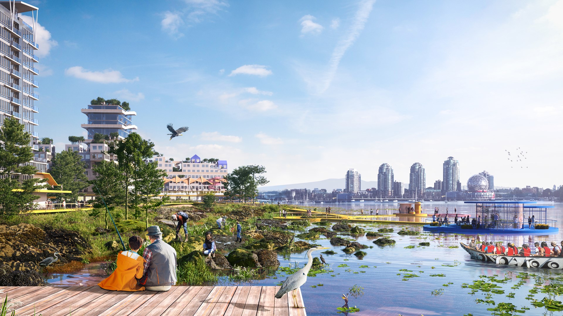
Sea2City invited two teams to investigate the urban future of False Creek. The design team – which included PWL Partnership Landscape Architects, Deltares, Modern Formline Design and an interdisciplinary resource team – worked on long-term proposals for the Between Bridges and Coopers’ Park areas. They created a re-wilding vision for the larger system of the False Creek waterfront and these concrete sites’ futures in 2100 and beyond, as well as a series of transition stages to get there, including proposals for pilot projects to take the first steps. The 2100 Re-wilding False Creek vision incorporates the cultural knowledge of the Local Coast Community (Musqueam Indian Band, Squamish Nation and Tsleil-Waututh Nation), learning from these communities’ reciprocal lifestyle with nature.
Fundamental to the team’s proposals is the recognition that traditional approaches to urban waterfronts, which revolve around resisting the water with hard infrastructure, are no longer effective in an era of rising sea levels and more frequent extreme weather events. The proposals thus centre on allowing the city to coexist with the water.
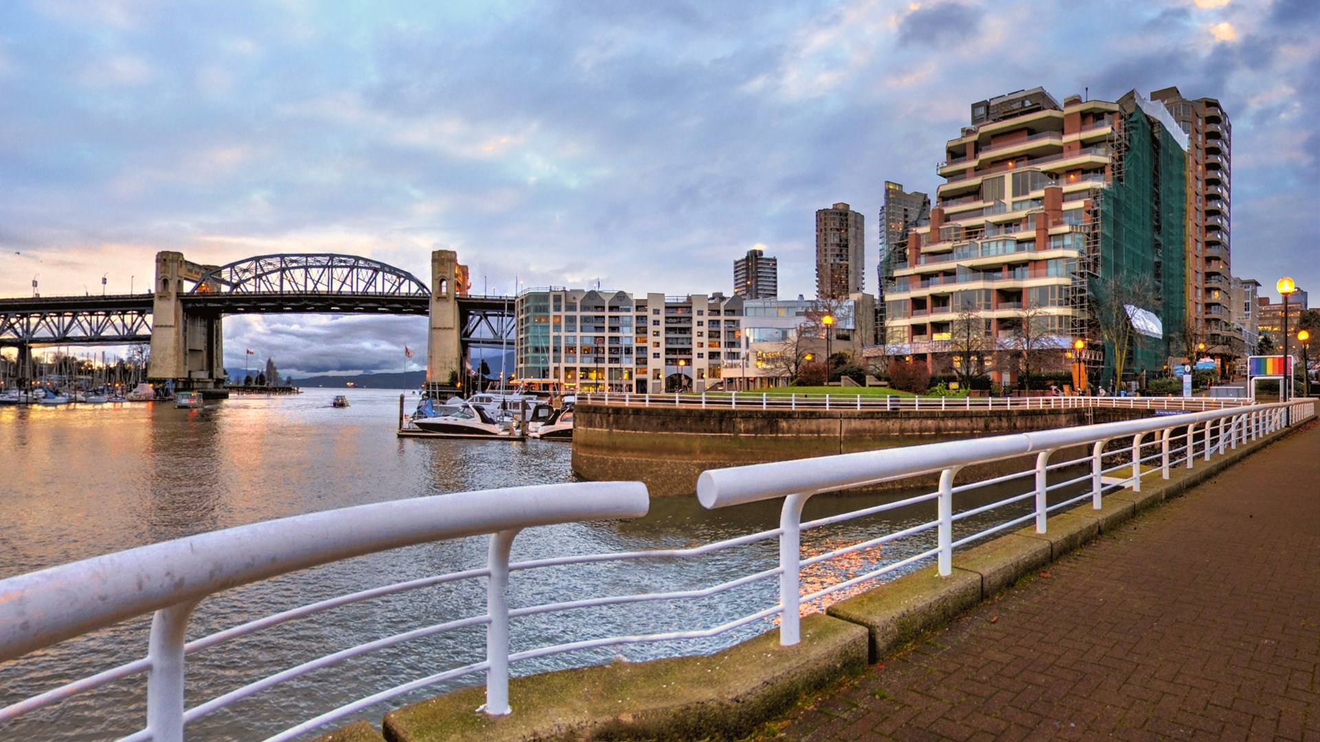
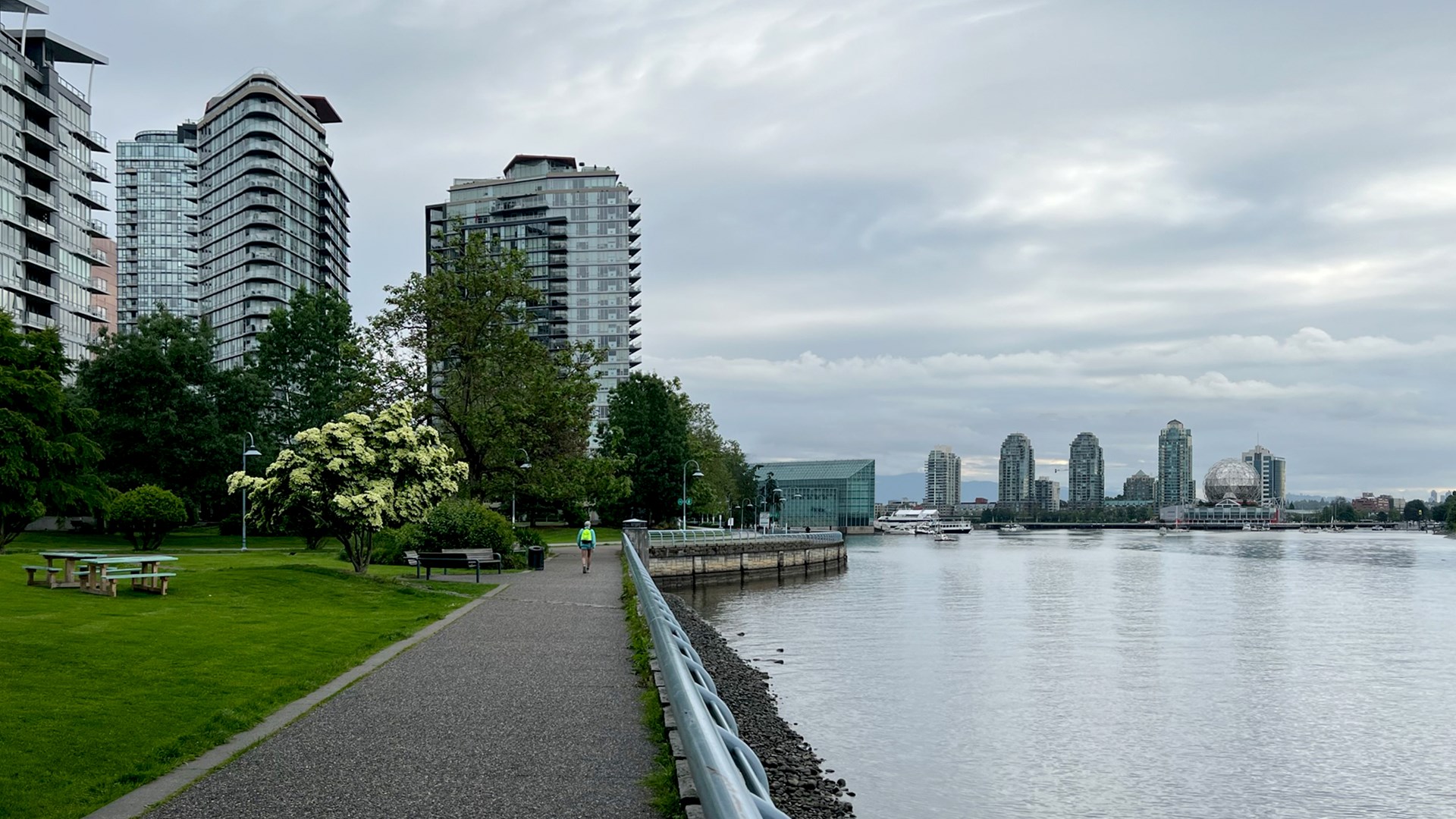
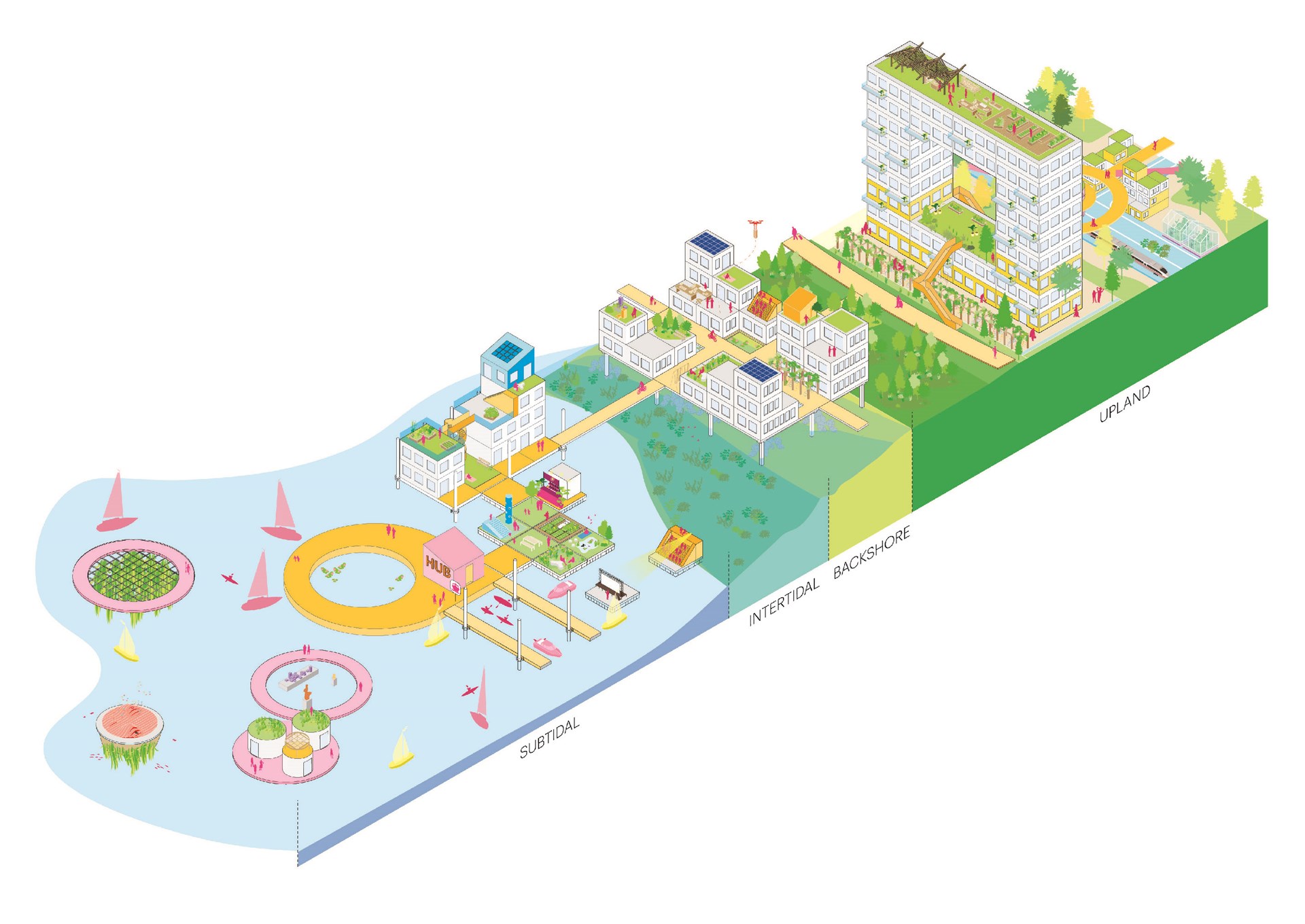
Analysing the historical and existing conditions, the team showed that the water’s edge in False Creek has minimal space dedicated to the inter-tidal zone – the land between high and low tide – and often no land at all serving as what is known as the “backshore” – land that can be expected to flood seasonally or during extreme weather events. What can be done to allow these areas to dramatically expand and form a more natural transition between sea and land? Can existing and new buildings be redesigned to work with the tides and floods? And in return, can the city expand to make symbiotic life with the water part of its urban culture?
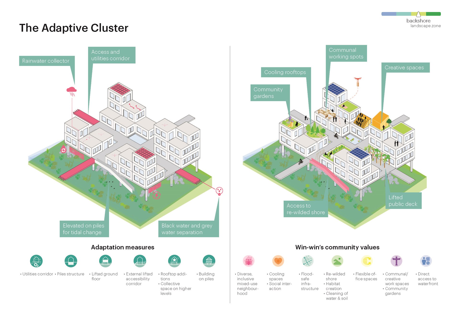
The proposal makes use of six fundamental principles that make these changes possible, both when adapting existing structures and constructing new ones. These principles are: upgrading utilities and elevating some of them away from the water; finding new, flood-proof uses for underground structures; lifting the ground floor of buildings; developing raised walkways to connect structures; rearranging buildings’ programmes and making them more flexible; and adapting structures to enable changes in use, as well as designing new structures to be more easily adapted.
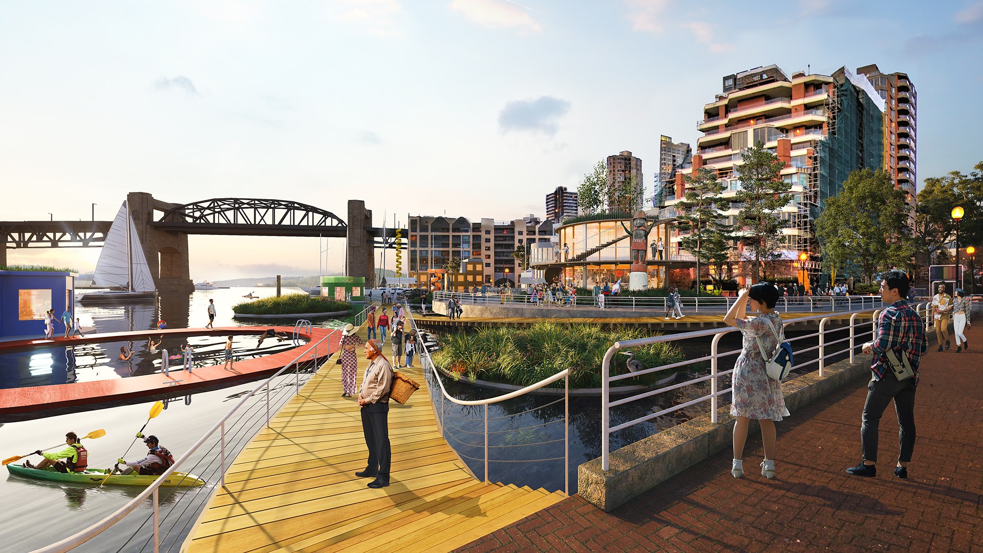
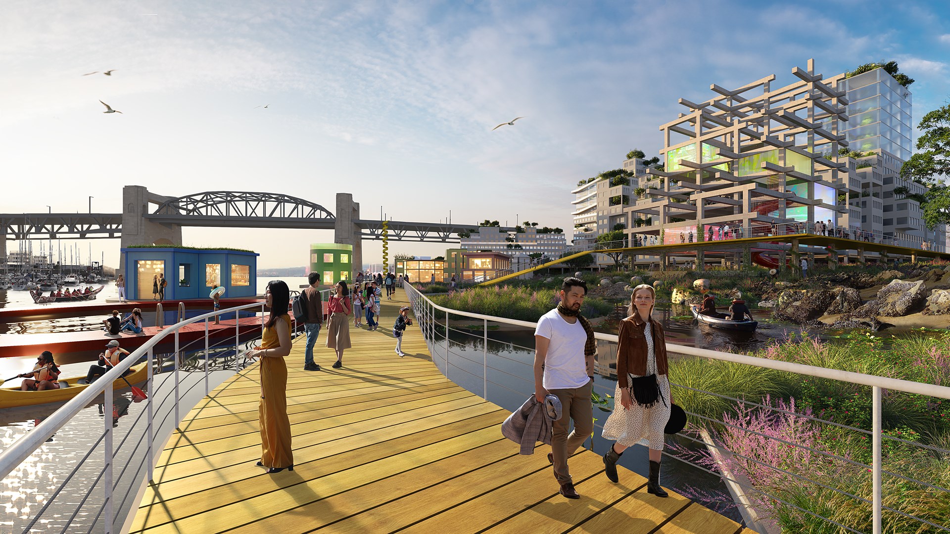
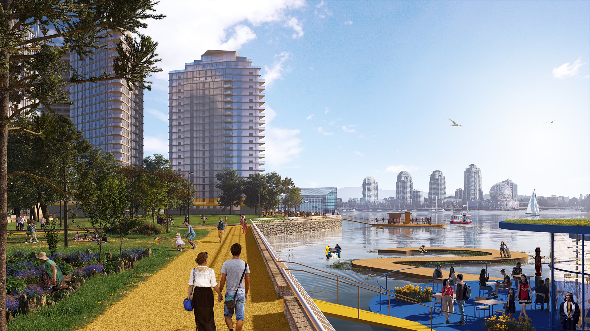
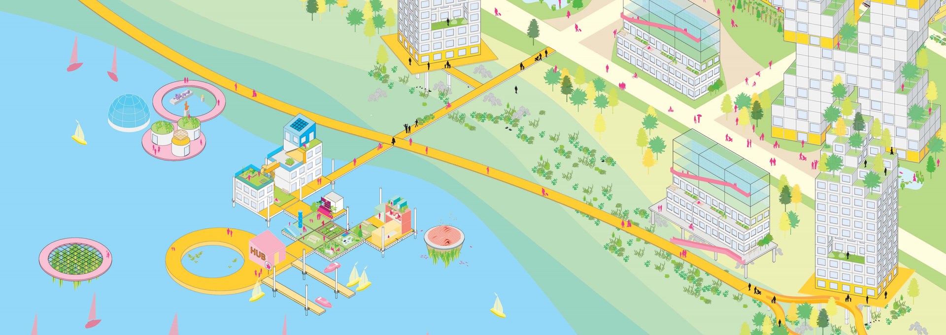
Using these principles, the Between Bridges site becomes a place where urban and aquatic life overlap and thrive together, with improved connections to the rest of the city, while the Coopers’ Park site is transformed into a tidal garden, in which adaptive buildings and a plethora of public pavilions for activities, mobility, and biodiversity respect and support the restoration of the natural waterfront.
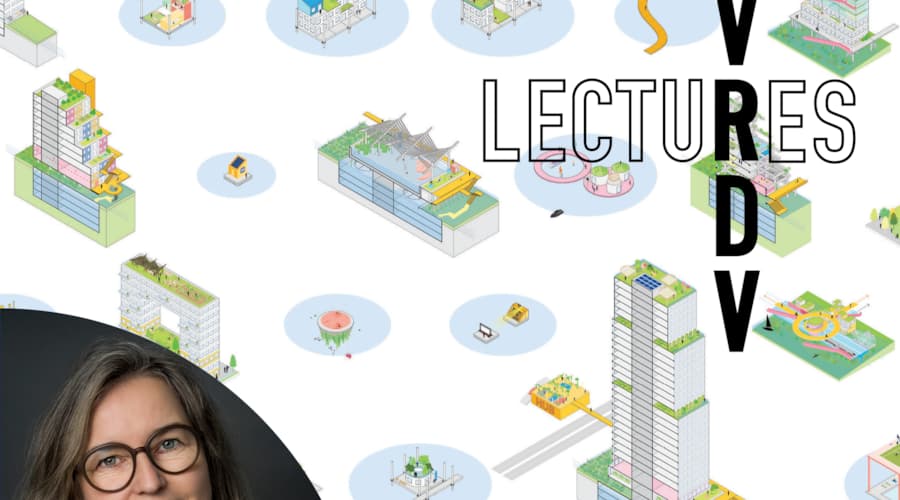
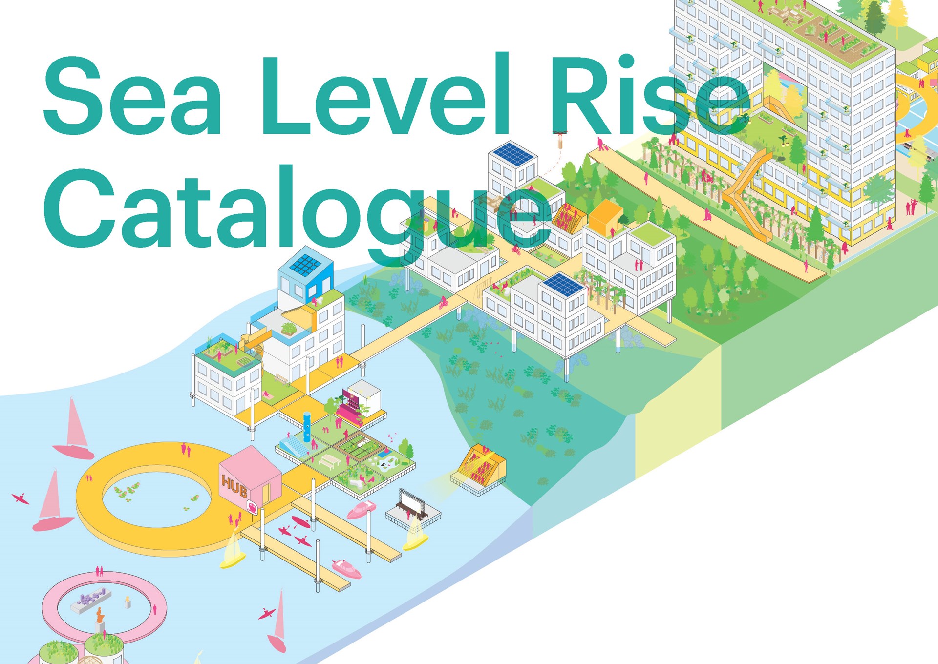
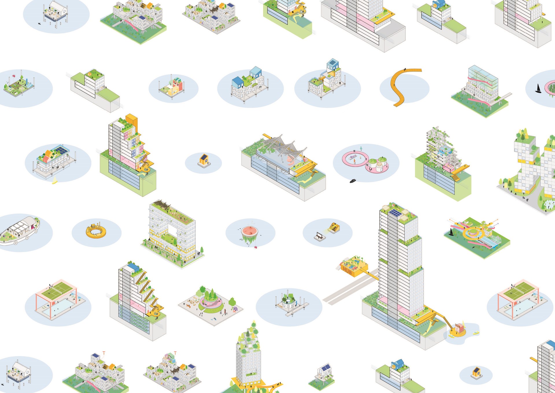
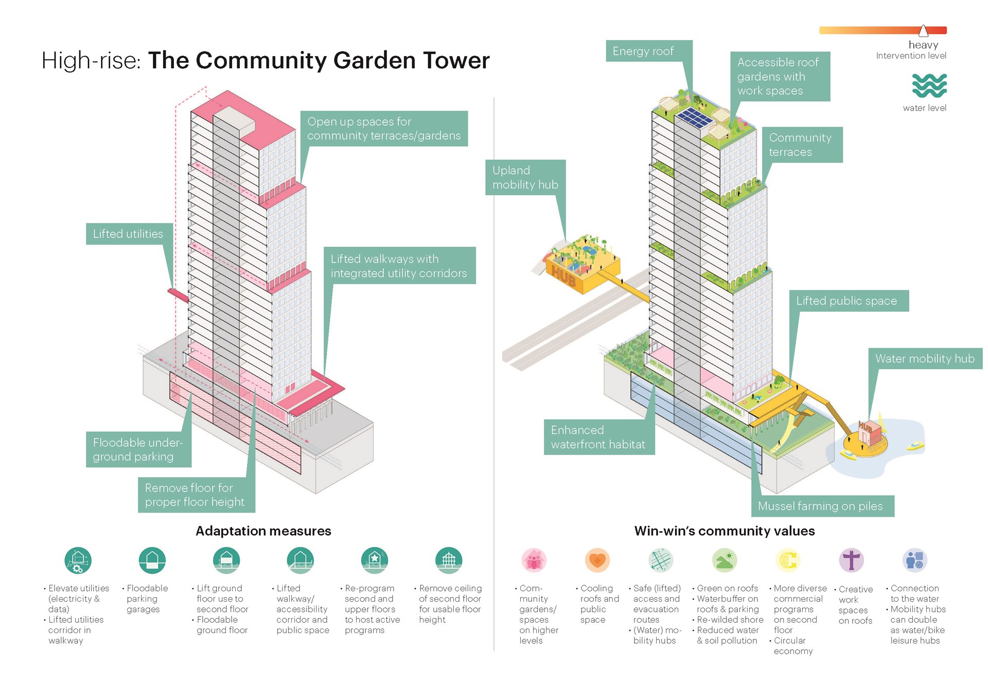
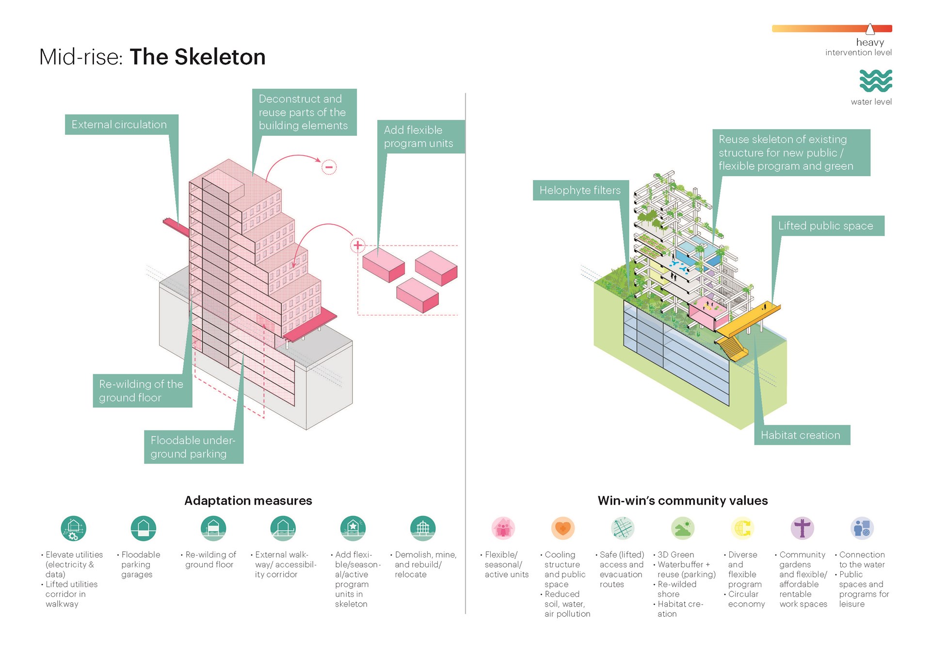
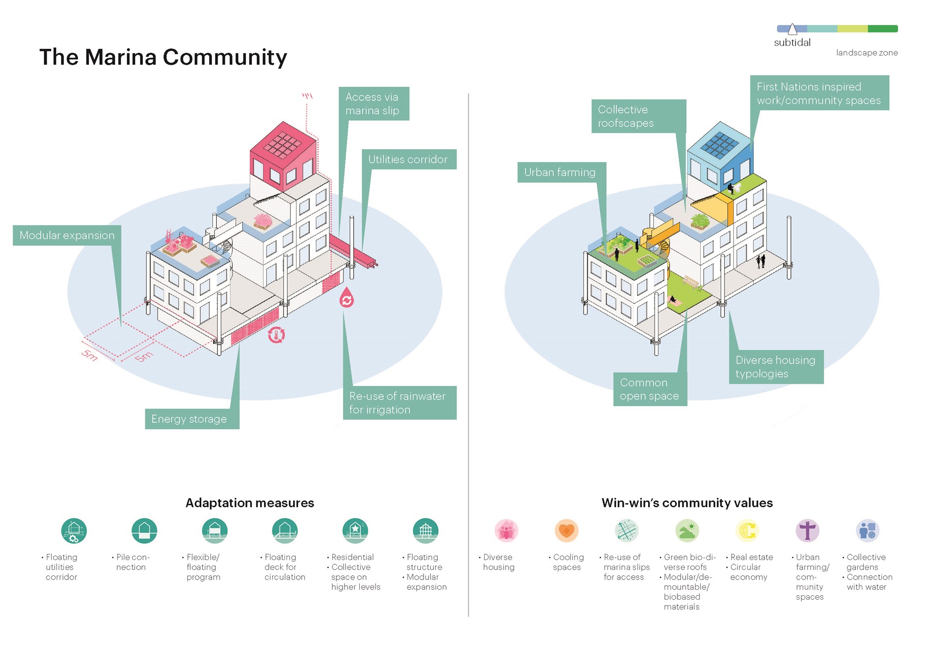
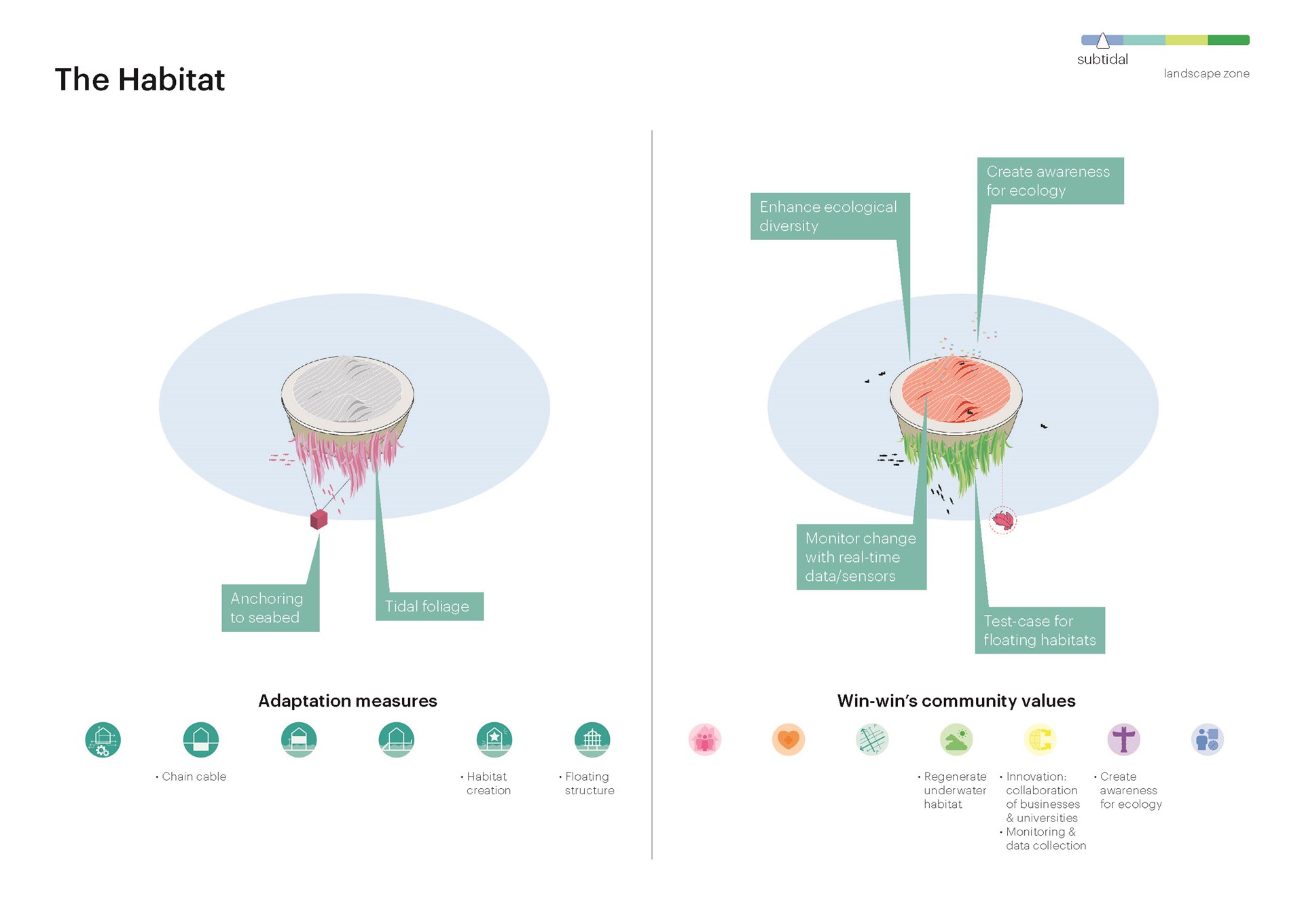
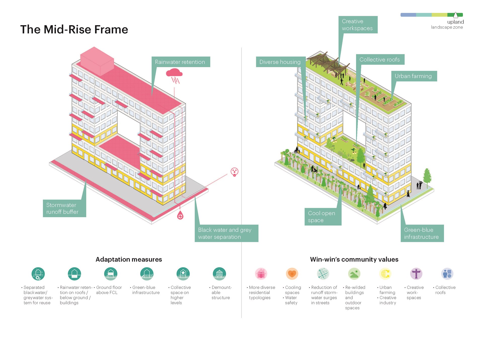
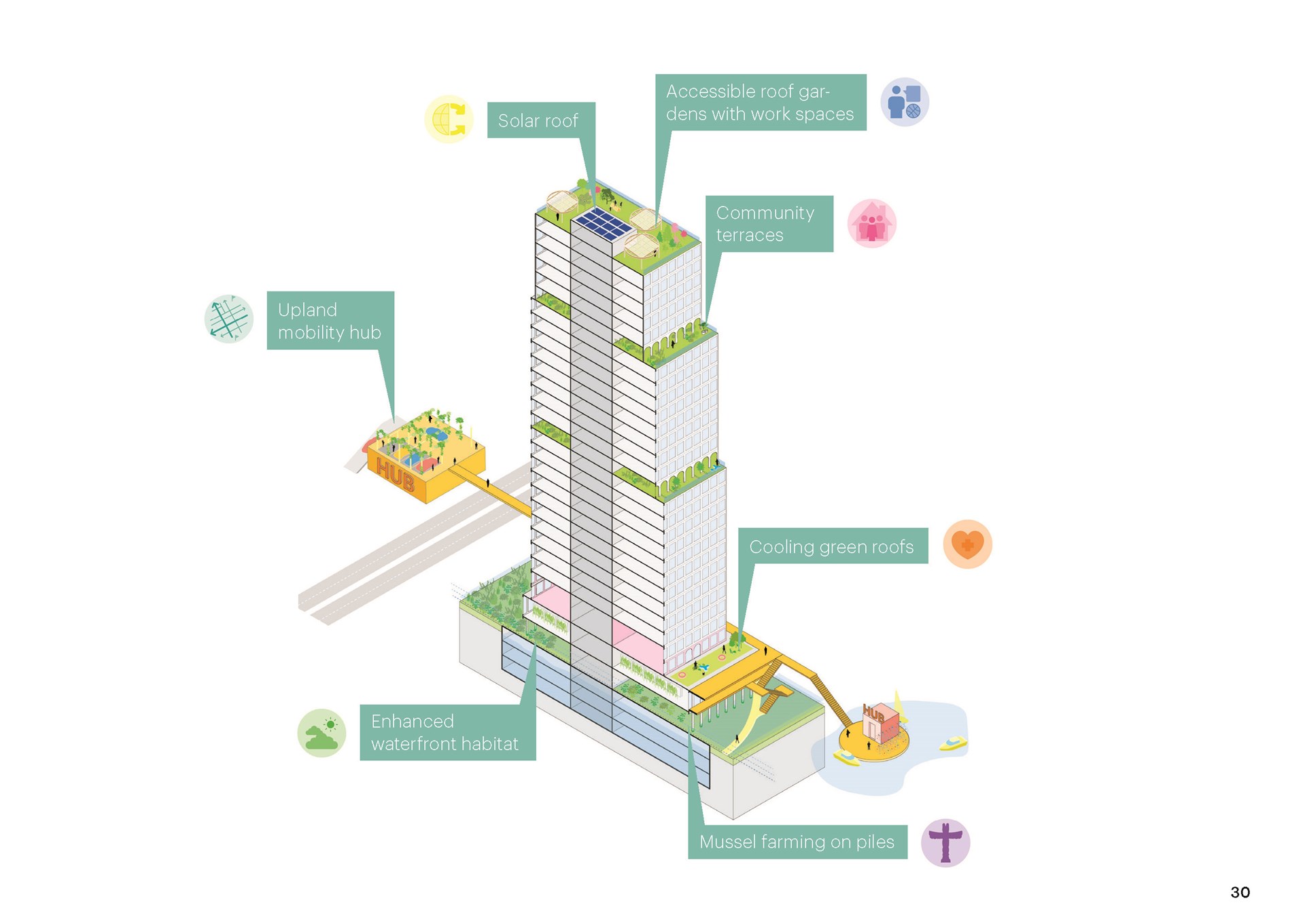
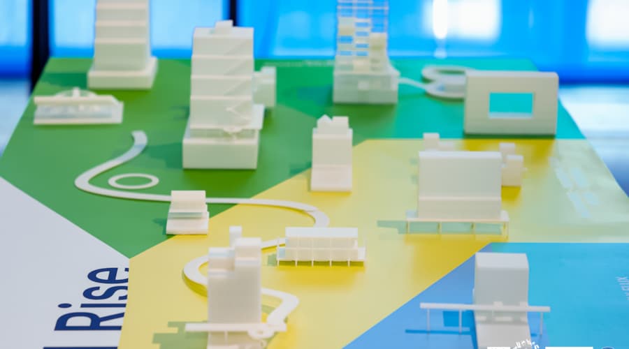
Expanding upon the proposal, MVRDV developed a “Sea Level Rise Catalogue”, with a strategy for both new buildings and for transforming existing individual structures in various locations, under various circumstances, and for a wide variety of purposes. The catalogue includes vertical extensions of flood-adaptive townhouses with community terraces, mid-rises stripped back to their structural skeletons to accommodate flexible public programmes, and high-rises serving as mobility hubs to connect land- and water-based transport. Ideas for new constructions include floating habitat islands, adaptive houses, offices, sports facilities, and cultural spaces; mixed-use high-rises and small neighbourhoods on stilts; an amphibious restaurant that rises and falls in response to the tide; and inland developments that bolster the city’s flood resilience by incorporating permeable ground coverings, community spaces, and rainwater buffers.
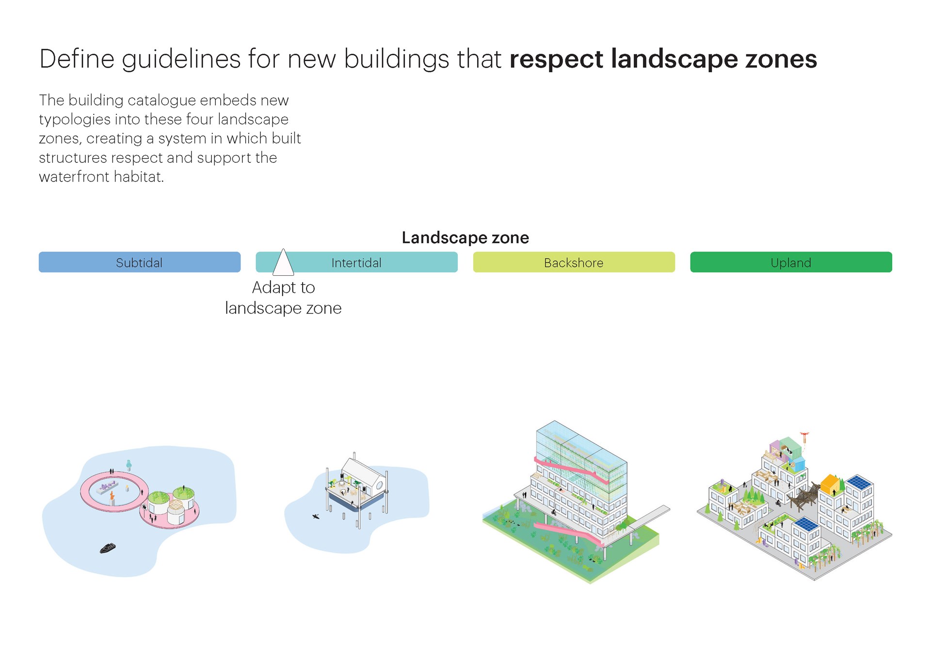
Each entry in the catalogue is categorised by the place it can occupy in the future city. Proposals for newly built structures are each given a location in relation to the re-wilded shoreline landscape, with some that will permanently sit on water, some occupying the “intertidal zone” (the area between high and low tide), some in the “backshore” that will only be affected in flood situations, and finally some “upland”, out of the predicted reach of the sea. In the case of transforming existing buildings, proposals are categorised by how dramatic the intervention is and the amount of sea level rise they can accommodate.
Crucially, each idea is also accompanied by an explanation of potential “win-wins”: positive impacts the design can offer that make the city more equitable, sustainable, and liveable, in addition to their ability to address sea level rise. From incorporating renewable energy sources, to increasing housing provision, and from adding public spaces to improving biodiversity, each proposal offers something in addition to its relationship to the water that can help to ensure widespread support among various stakeholders.
A number of these catalogue proposals are incorporated into the long-term plans for False Creek, with four proposed interventions in each area highlighted as pilot projects. In the Between Bridges area, these four pilot projects are a First Nations Pavilion that provides education on indigenous land stewardship practices, a number of Mini Forests to add greenery to the area, a floating Habitat Island for marine life, and a Paddler’s Pavilion that allows people to enjoy the water. In Coopers’ Park, pilot projects include a water mobility hub to enable water-based transport, a floating First Nations Restaurant, a Plant Nursery for native flora, and a floating walkway, that begins the park’s expansion onto the water.
Gallery

Credits
- Architect
- Founding Partner in Charge
- Director
- Design Team
- Visualisations
- Partners
- Contractor:
- City of Vancouver
- Landscape architect:
- PWL Partnership Landscape Architects Inc.,
- Environmental advisor:
- Deltares
- Cultural advisor:
- Modern Formline Design
- Advisory group:
- Westmar Advisors
- Modus
- Goudappel
- The Happy City

.jpg?width=900&height=500&quality=75&mode=crop&scale=both)
.jpg?width=300&height=300&quality=75)
.jpg?width=300&height=300&quality=75)
