Marvila Masterplan
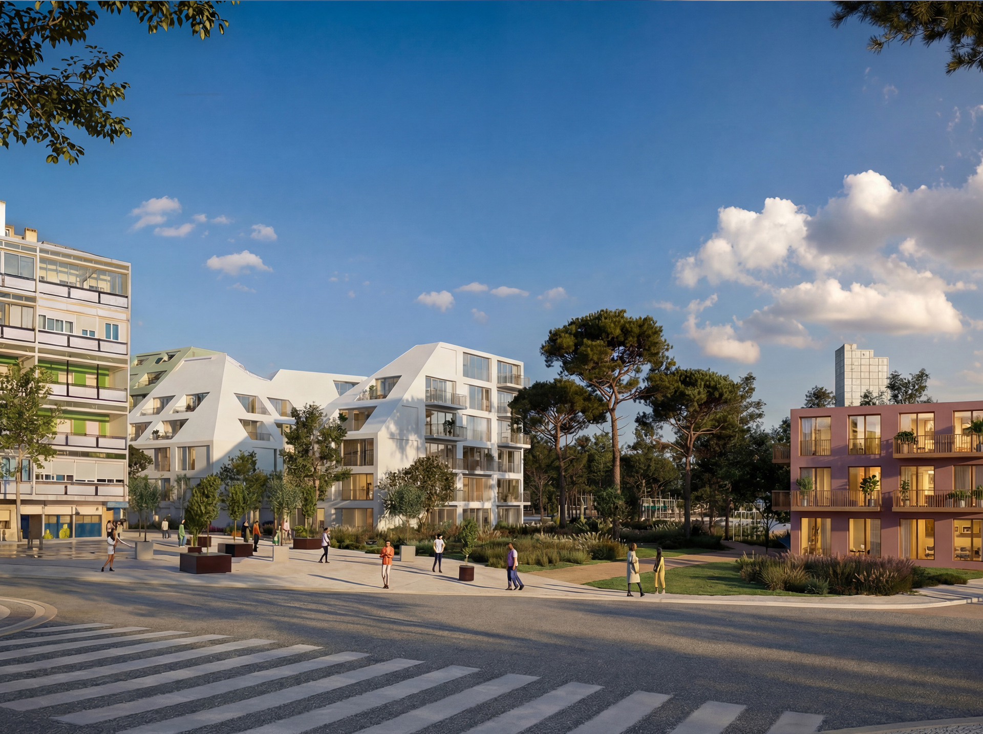
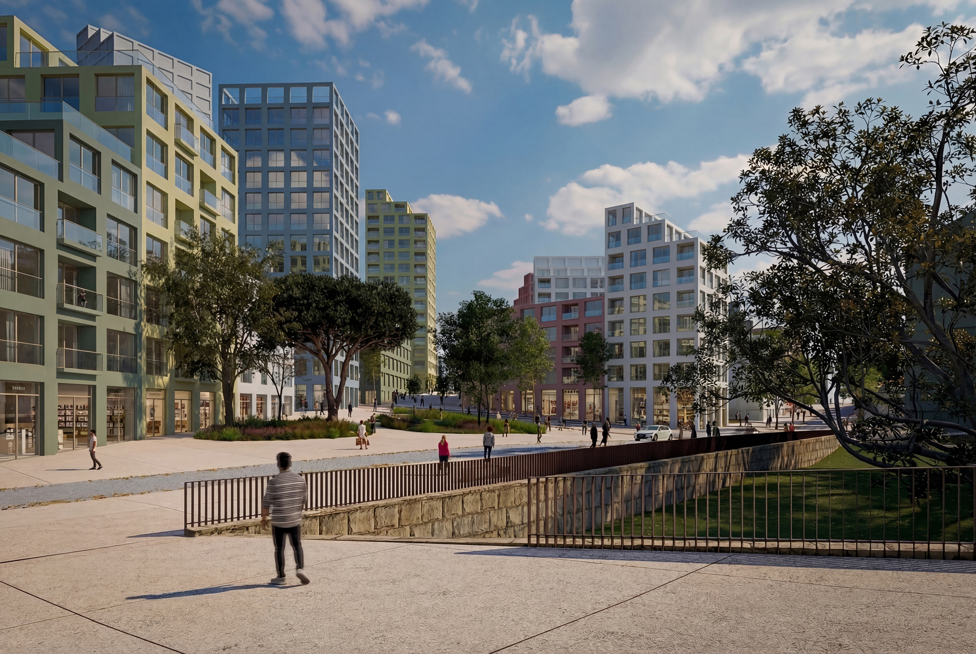
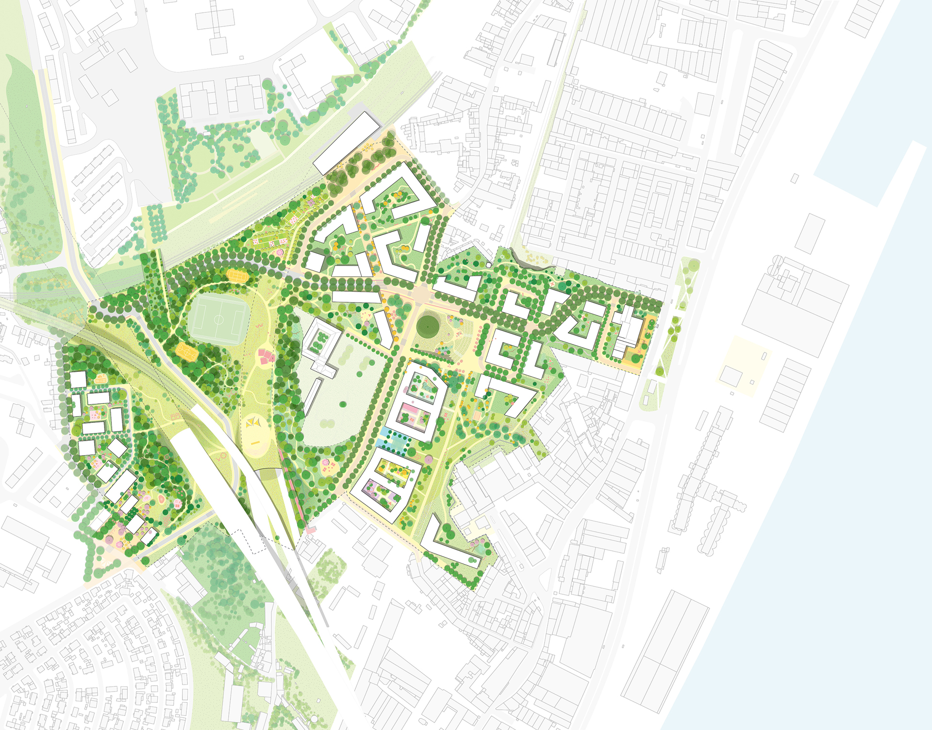
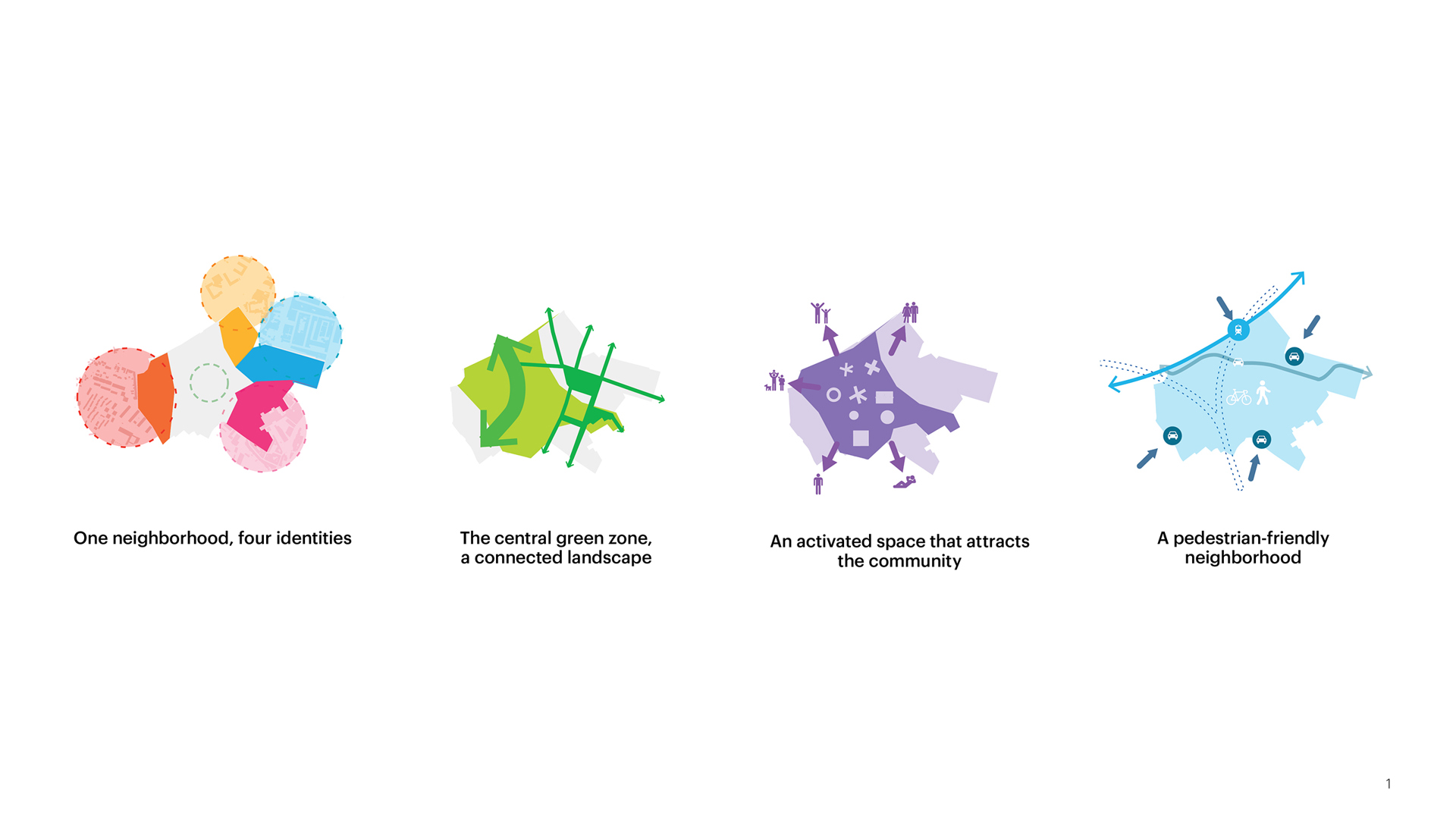
The Marvila Masterplan covers approximately 28 hectares between Marvila and Beato on Lisbon’s riverfront. Developed by MVRDV and OODA, in collaboration with LOLA Landscape Architects and Thornton Tomasetti, the plan defines a new urban and landscape framework for one of the largest regeneration projects currently under development in the city, introducing 1,400 homes alongside public facilities, commerce, and services. It transforms a fragmented and largely abandoned territory into a new urban centre, structured around four areas – each of which is given its own identity, yet connected to the others by a continuous system of public space, landscape, and mobility.
- Location
- Lisbon, Portugal
- Status
- In progress
- Year
- 2022–
- Surface
- 278896 m²
- Client
- 1875 FINANCE
- Programmes
- Mixed use, Residential, Industrial, Infrastructure, Master plan, Public space
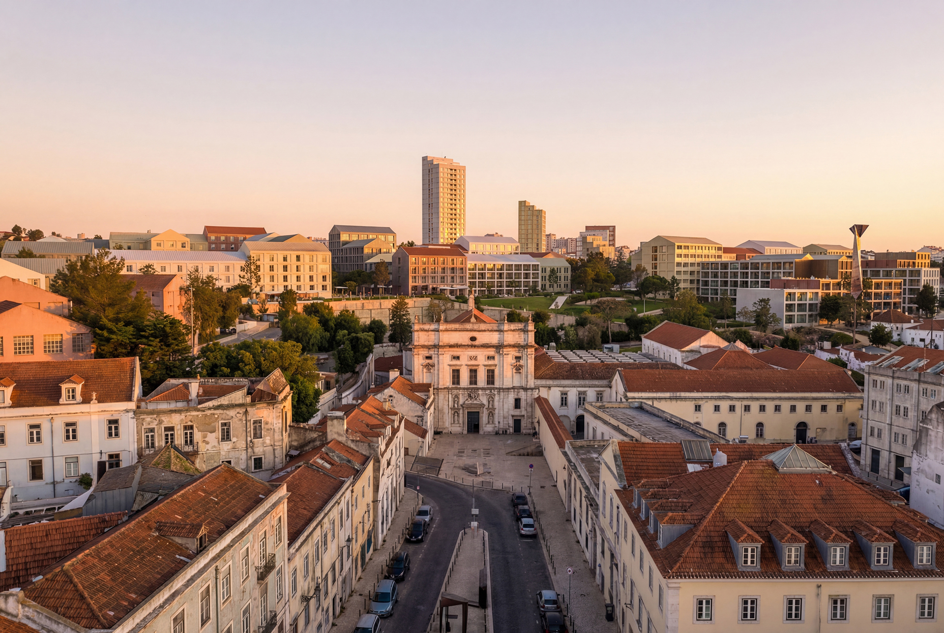
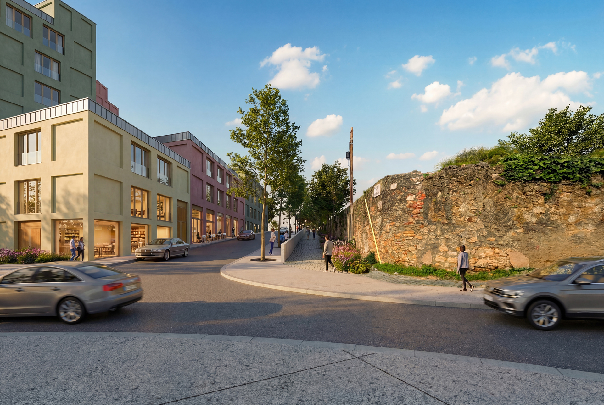
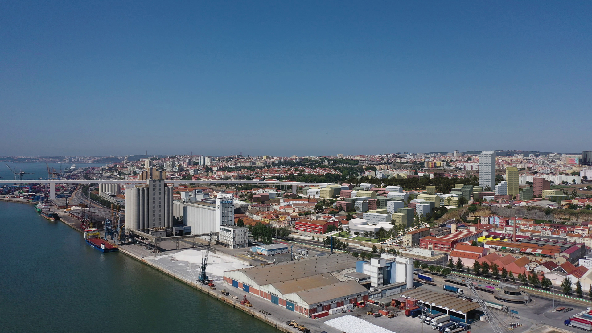
Located on Lisbon’s eastern riverfront, the Marvila Masterplan site has experienced layer upon layer of transformation, yet remains underused and largely disconnected from the city. It was once agricultural land owned by wealthy Lisbon families, then starting in the late 18th century was shaped by early industrial development. Railway lines crossing the area have, over time, created a physical barrier that separates it from its surroundings and from the River Tagus. Today in spite of its strategic position between Lisbon’s centre and the Parque das Nações area, it remains a fragmented part of the city. Vacant plots, obsolete infrastructure and a lack of quality public spaces conceal an area with significant untapped potential.
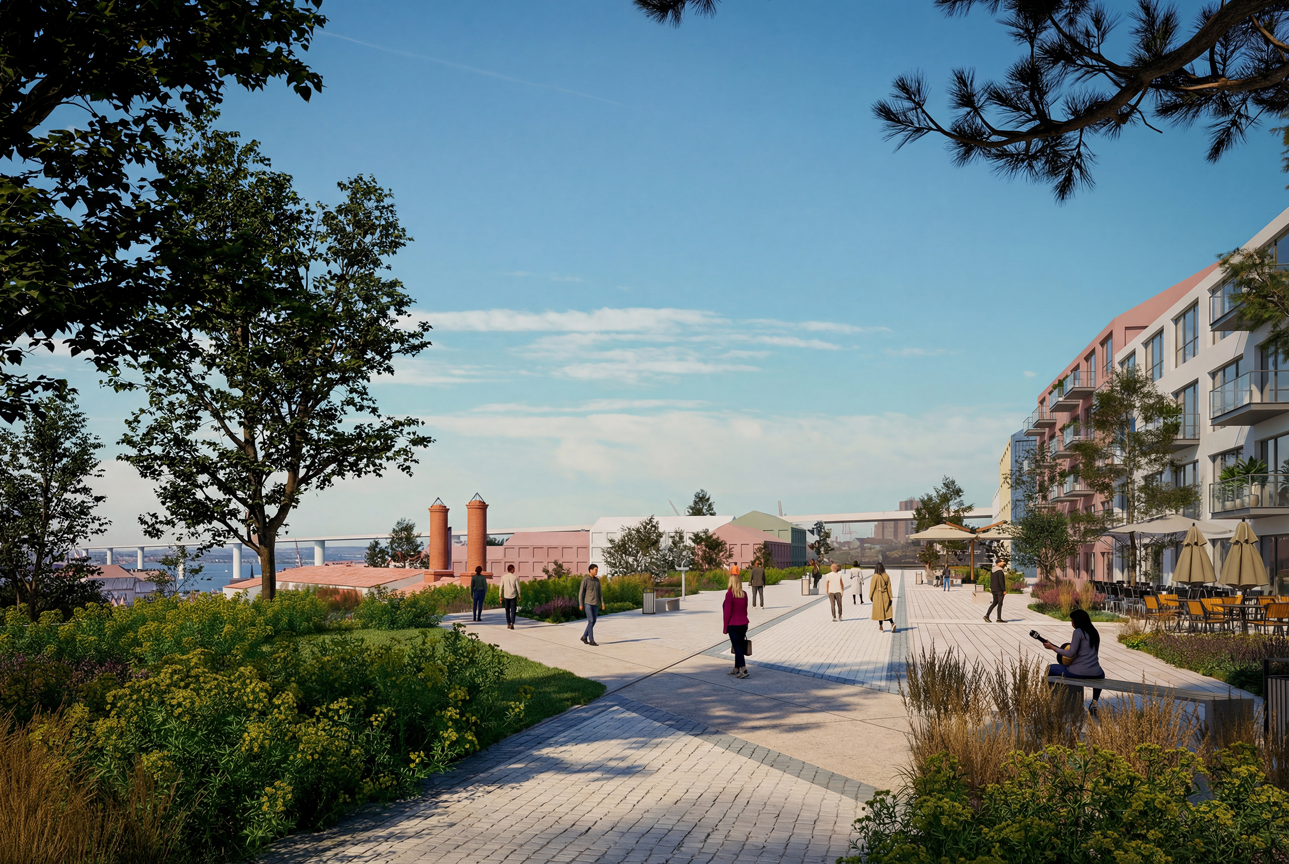
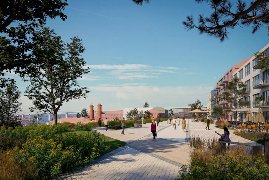
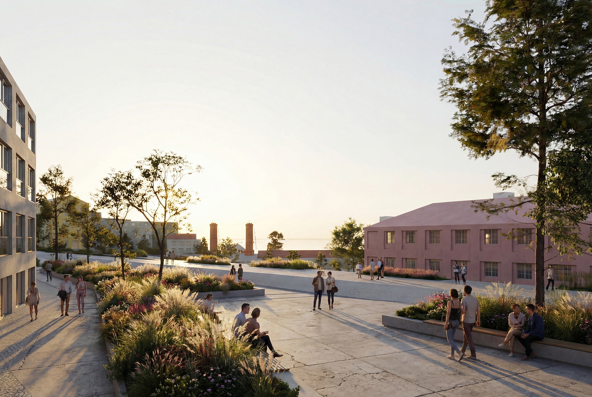
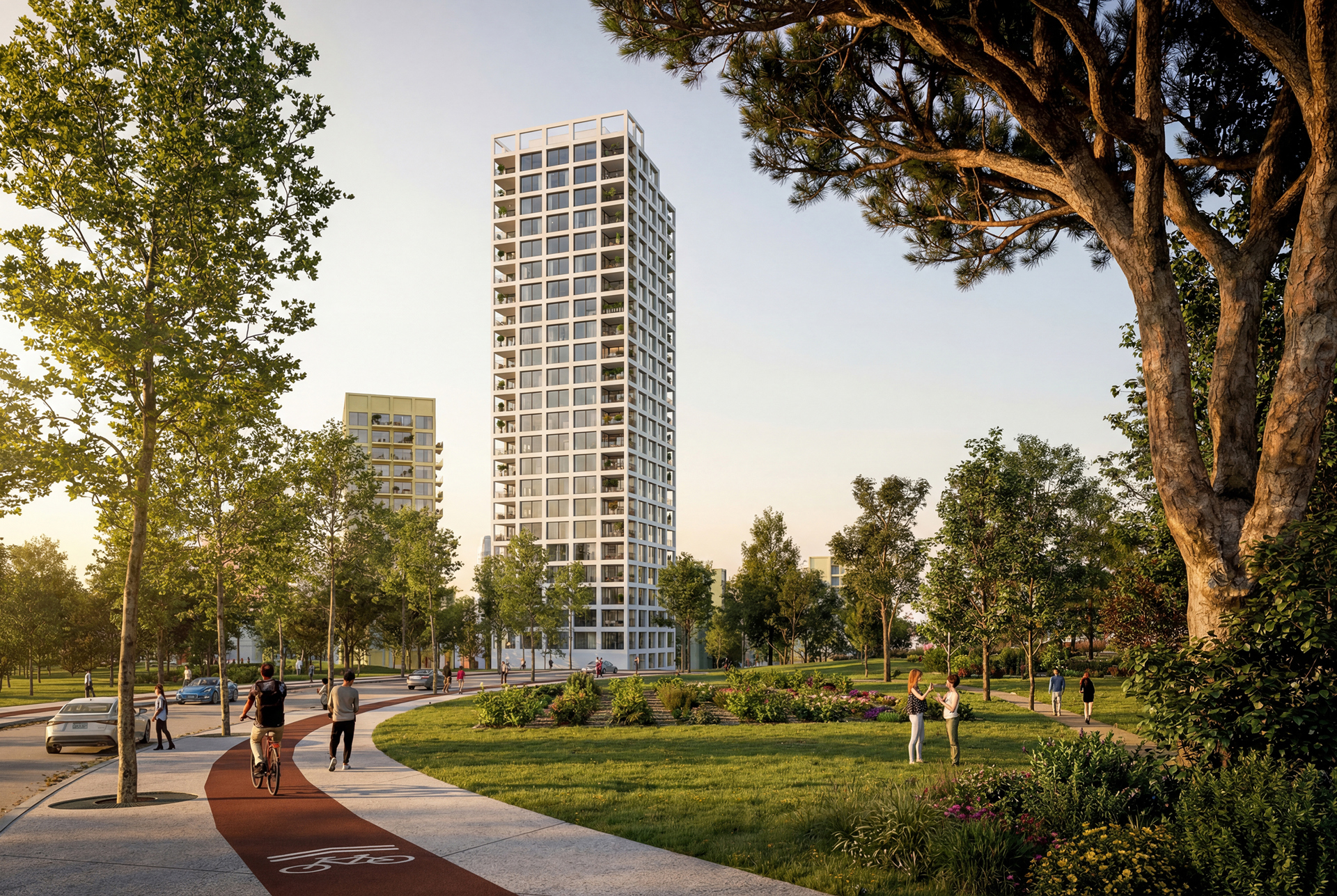
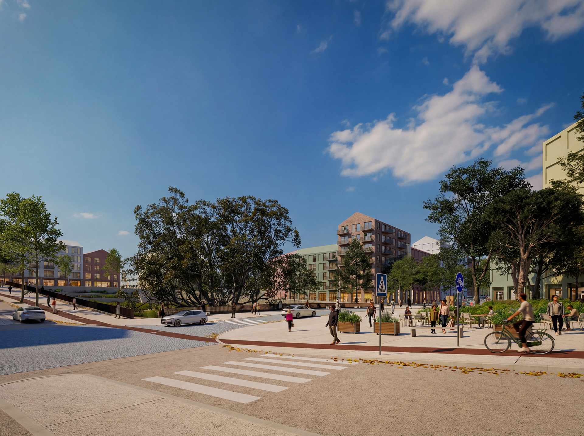
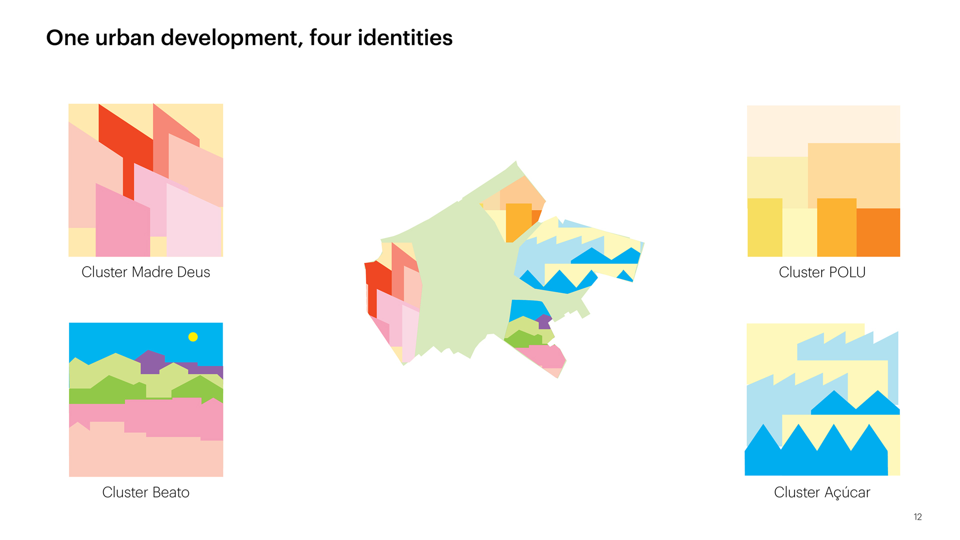
The masterplan is organised into four distinct clusters related to the adjacent neighbourhoods – Açúcar, POLU, Beato and Madre Deus – each with its own identity while forming part of a continuous urban system. The size and placement of buildings respond to topography, views and the surrounding urban fabric, creating transitions in scale and minimising the impact on neighbouring areas. Heights and densities vary across the four zones, with courtyards, open blocks, and public routes ensuring permeability and continuity. In order for the site to remain active and usable during the construction, each phase of the masterplan includes development of public space and green infrastructure.
News
MVRDV and OODA’s Marvila Masterplan regenerates a fragmented and vacant piece of Lisbon into a landscape-led urban centre
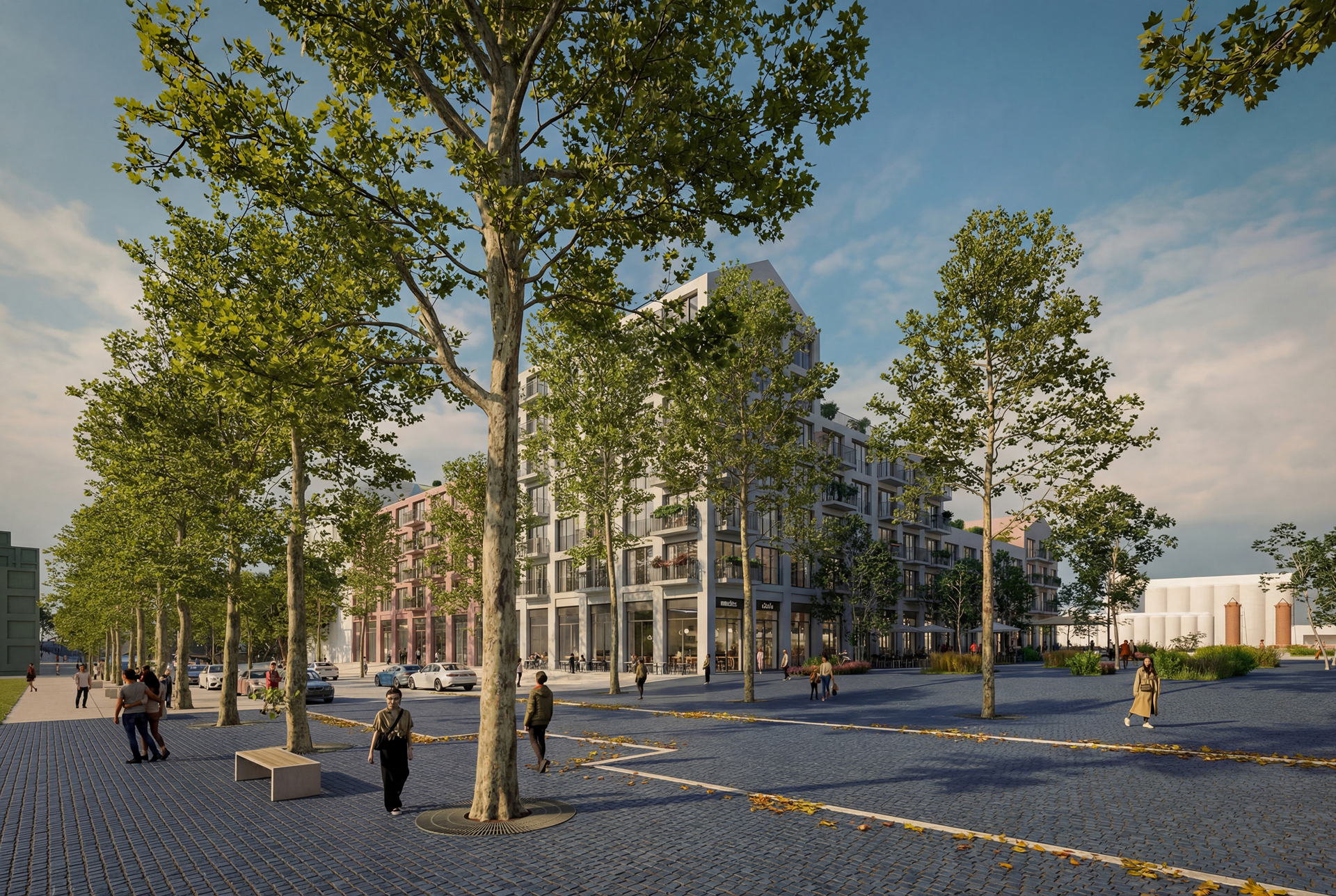
more informationThe plan accommodates approximately 1,400 homes with a variety of typologies, including affordable and social housing, and combines these with public facilities such as a day centre and a care home, as well as spaces for commerce and services. This mix of functions allows the area to remain active throughout the day and to serve a diverse range of users. The proposal also integrates existing cultural and natural heritage, such as the Convento do Beato, or a centuries-old rubber tree that will become the focal point of a new public square. This focus on reuse, along with the integration of renewable energy production including solar panels and the use of innovative materials, contributes to reducing the project’s carbon footprint.
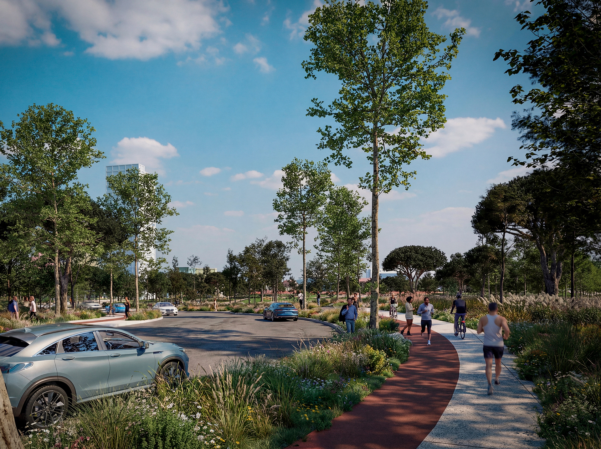
The landscape strategy integrates water retention and infiltration zones across the site, with drought-resistant planting and habitats for local species strengthening biodiversity. A central urban park links the four clusters through a sequence of squares, courtyards, and green corridors. It functions as a space for leisure and community activity, incorporating pedestrian and cycling routes, connections to the waterfront, and a range of uses including sport, urban allotments, and events. At the same time, the park addresses the impact of large-scale infrastructure, mitigating the impact of the future Third Tagus Crossing bridge (TTT) that will cut across the site by introducing green buffers and covering parts of its structure.
This approach extends to the existing railway infrastructure, with a new deck placed over the Northern Line tracks to remove this long-standing barrier across the site. The intervention restores pedestrian continuity between Chelas station and the waterfront, while creating new public space and viewpoints over the Tagus. The proposal also includes a new building for Marvila station, strengthening integration with public transport, and a reorganised road network that connects different topographic levels and prioritises pedestrian and cycling connections between surrounding areas.
Gallery

.jpg?width=1920)
.jpg?width=1920)
.jpg?width=1920)
.jpg?width=1920)
.jpg?width=1920)
.jpg?width=1920)
.jpg?width=1920)
.jpg?width=1920)
.jpg?width=1920)
.jpg?width=1920)

Credits
- Architect
- Founding partner in charge
- Partner
- Design team
- Business Development
- Collaborators
- Co-architect:
- OODA
- Landscape architect:
- LOLA Landscape Architects
- Structural engineer:
- Thornton Tomasetti
- Project coordination:
- PFXCO